
NATURE by Kezia Bacon, Correspondent
It’s June, and summer is just around the corner. We’ve already had some hot days, and the water is now starting to warm up. It’s paddling season! Time to pull your kayak, canoe or paddleboard out of storage! Whether you’d prefer a river, a pond, or the open water, there are numerous options within a few miles from home.
This month, be sure to follow NSRWA’s Explore South Shore Contest, in which we feature some of the South Shore’s lesser-known paddling spots. We invite you to visit them, and then post a photo from your adventure to Instagram with the hashtag #ExploreSouthShore. Each month we randomly select a winner from the posts to receive a prize package. Also this month, every day on Instagram, we’ll be featuring a new and different place to launch your kayak.
Click here to download the 2021 North River Tides for Paddling Chart. (Once you fill out the form you will be redirected to the download.)
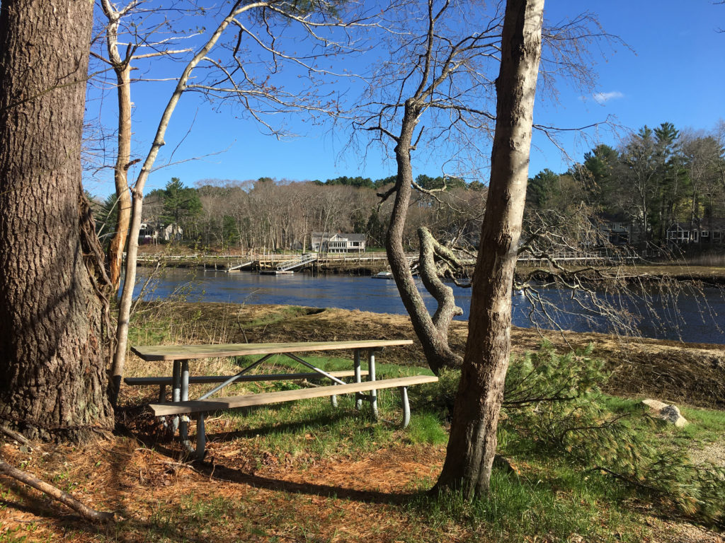 Some of my favorite kayak launches are on the North River. The Pembroke Town Forest on Brick Kiln Lane is open to the public and offers access to the river at all tides. If you put your boat in the water at ocean high tide, you can enjoy a 2-hour out-and-back excursion in either direction, up- or downstream. Also open to all, the Marshfield Launch, at the Union Street Bridge. Similar to Pembroke, there are plenty of options for out-and-back excursions if you start a couple hours before ocean high tide.
There are also North River launch spots at three sites in Norwell — across the river at the Norwell Town Landing, upstream at Chittenden Lane, and downstream at Bulman Marine on Route 123. You’ll need a Norwell sticker to park at the Town Landing and Chittenden. Bulman Marine makes it easy, with a small fleet of canoes and kayaks available for rental on-site. One more North River launch is Damon’s Point, which is accessible at any tide.
 The launch I use the most on South River is Marshfield’s Francis Keville Bridge, which is located a short distance down the Rail Trail behind the CVS on Ocean Street. If you start 2-3 hours before the ocean high tide, you can enjoy a peaceful out-and-back excursion to various points downstream. Another option is a one-way trip for which you’d leave a second vehicle at either of the next two spots I’ll mention. The dunes behind Marshfield’s Rexhame Beach. If you launch an hour before high tide, you can have a lot of fun explore the creeks nearby, or try an out-and-back starting upstream. Another option is the Marshfield Town Landing on Ferry Street, which has a similar timetable.
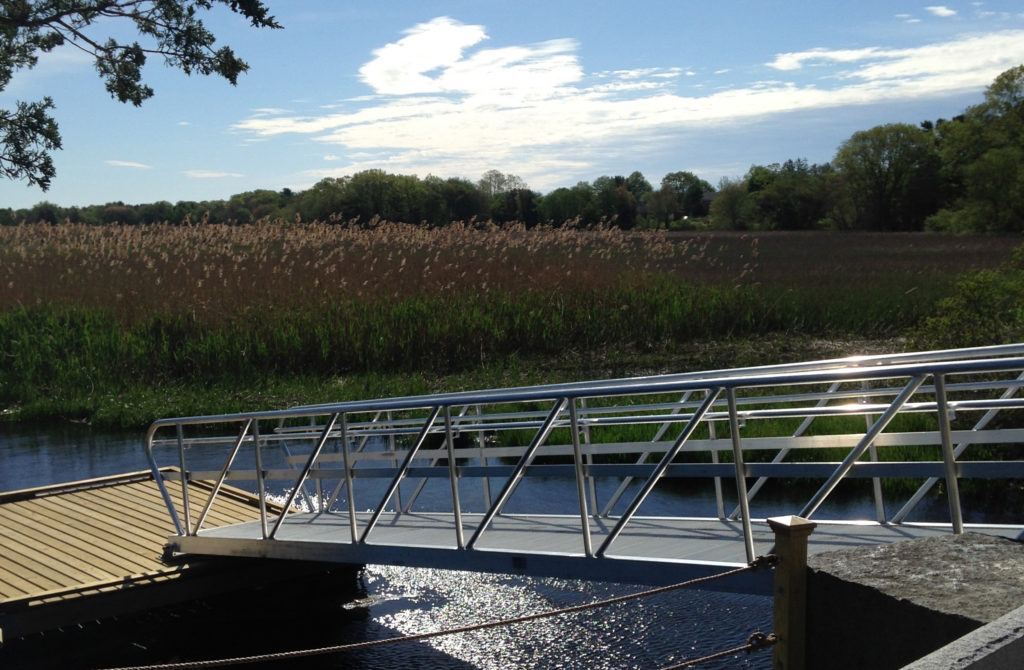
Don’t miss the major tributaries to the North River. Access the downstream portion of the Indian Head River, as well as the beautiful upper reaches of the North, from the Hanover Public Launch on Indian Head Drive. Start a couple hours after ocean high tide for a nice out-and back. You can also paddle upstream on the Indian Head, starting above the dam at Luddam’s Ford Park — both in Hanover and in Pembroke. There’s no tide to consider there, but be sure to steer clear of the dam! Also consider the Herring River, which flows through Driftway Conservation Park in Scituate. Start an hour before high tide and head inland (toward 3A) as you pass The Spit. You’ll have a couple hours to explore the estuary before heading back.
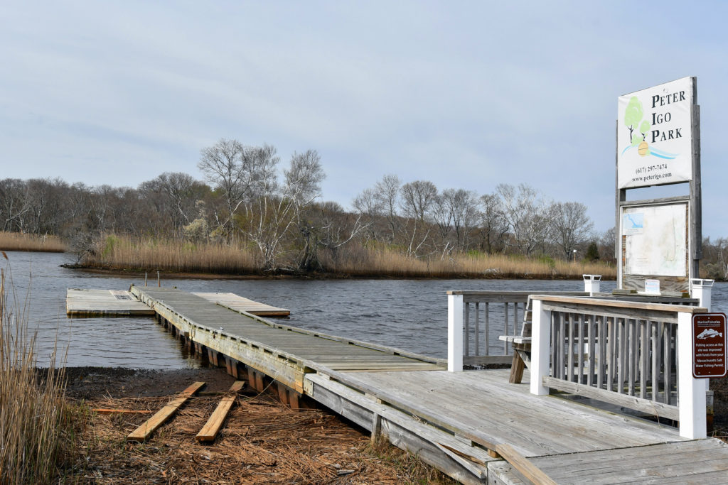 Extending beyond our watershed, other rivers to consider include the Green Harbor River at Peter Igo Park in Marshfield, the Shumatuscacant River at Poor Meadow Brook Conservation Area in Hanson, and the Back River at Abigail Adams State Park in Weymouth .
If you’d prefer a simpler, potentially calmer outing, consider our local ponds. Jacobs Pond Conservation Area in Norwell offers a special launch for people with disabilities. Rockland’s Studley Pond is a natural oasis amidst a busy downtown. Forge Pond in Hanover is small but fun to explore. Also, Duxbury’s Island Creek at Crooker Memorial Park, has a pond-like feel.
In Hanson, you can choose from Indian Head, Wampatuck, and Maquan Ponds. And in Pembroke, there are four: Stetson, Furnace, Oldham and Little Sandy Bottom, all with public access.
 If it’s the open water you crave, one great place to begin is Duxbury Bay. Launch your kayak from the small parking area on the inland side of the Powder Point Bridge. Head inland (under the bridge), where you’ll find plenty to explore. Another excellent spot in Duxbury is Howland’s Landing Park, with access to Kingston Bay and Standish Shores. However tempting, be sure to avoid the mouth of the North River, which is extremely dangerous for small watercraft.
For detailed information on all of the spots mentioned above, consult the Get Outdoors/Paddling section our website. For a better understanding of tides and trip-planning, check out our Timing the Tides Guide.
See you on the water!
Kezia Bacon’s articles appear courtesy of the North and South Rivers Watershed Association, a local non-profit organization devoted to protecting our waters. For membership information and a copy of their latest newsletter, contact NSRWA at (781) 659-8168 or visit www.nsrwa.org. You will also find 25+ years of Kezia’s Nature columns there. For more information about the Explore South Shore 2021 Contest, visit https://www.nsrwa.org/get-outdoors/explore-south-shore-2021-contest/