 NATURE
by Kezia Bacon, Correspondent
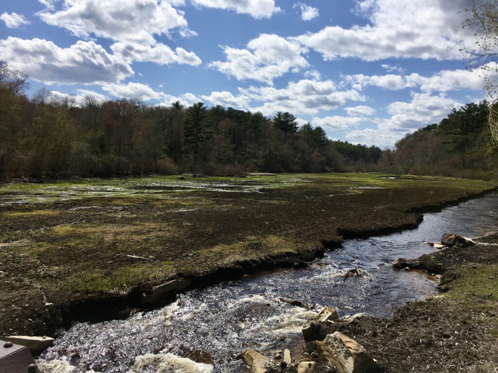
Dams can be found on many of our local rivers and streams – some dating back to the 1600s. Originally a power source for mills and factories, they remained in place long after those industries faded. Most are no longer needed. Aging and sometimes unstable, they do more harm than good.
In the past two decades – thanks to collaborative efforts by town, state, and federal partners, as well as various watershed groups — a number of South Shore dams have been carefully disassembled. This is exciting progress! Not only does dam removal lessen the risk of flood-related liability for landowners, it is a boon for the environment — restoring and reconnecting river habitats, opening up fish passage, and improving water quality.
Does your local stream flow freely? Or are there dams along the way that hold it back and slow it down? Keep reading to discover nine local places where you can view free-flowing streams.
Also, don’t miss our 2023 Explore South Shore Challenge, Know Your Local Waters. Each week we feature a river, stream, pond or other waterway, and highlight public places you can visit to experience it first-hand. Watch for daily posts on Facebook and Instagram. The program also includes a weekly trivia question, with a chance to win a custom NSRWA prize package.

Town Brook Trail
A pleasant walking path extends for 1.5 miles along Town Brook in Plymouth – from Billington Street to Brewster Gardens. Alternately pavement, gravel and dirt, it offers several bridges and numerous spots to enjoy the view. Between 2002 and 2019, five obsolete dams were removed from Town Brook. The results are absolutely inspiring! Access at various points, including the town parking area on Spring Lane in Plymouth.
Billington Street Park
If walking the entire Town Brook Trail doesn’t appeal to you, consider making a stop at this small but powerful town park. A picturesque covered bridge offers a prime opportunity to observe how the area has changed in the 21 years since the first dam was removed. With natural river function restored, migratory fish such as blueback herring can now reach their spawning grounds in Billington Sea! Located at 4 Billington Street, Plymouth.
Eel River Preserve
Once a cranberry bog, this 130-acre property is slowly reverting to its original form — a white cedar swamp, bordered by forest, with 1.7 miles of river passing through. In 2010, the cranberry bog’s ditches, dams and culverts were removed, allowing the Eel River to flow freely. There are about 3 miles of trails. Located at the intersection of Long Pond and Boot Pond Roads, Plymouth.
Russell Mill Pond Conservation Area
A dam stood here as early as 1822, powering a series of enterprises including a sawmill, a barrell/box factory, and a textile mill. In 2010, the dam was removed, and replaced with a pedestrian footbridge, and the Eel River was allowed to flow freely. Cross the footbridge and enjoy 1.5 miles of walking trails with water views. Removing this dam has helped to restore wildlife habitat, improve water quality, and renew passage for migratory fish. Located at 204 Long Pond Road, Plymouth.

Sampson Forest and Memorial Park
For centuries, the dam at this historic spot was seasonal — removed periodically so fish could swim upstream. But in the 1920s, a permanent concrete structure was installed. While it provided a water supply for the town and power for local industries, it caused significant harm. Since 2019, when the dam was removed, fish populations have slowly improved. Water quality is likely to improve as well. Stop by to catch a close-up glimpse of a river restoring itself. There are also picnic tables and at least a mile of woodland trails. Located at 67 Elm Street, Kingston.
Hathaway Preserve
The first dam removal on the Jones River took place in 2011, when the one at Wapping Road was taken down. Kingston’s Hathaway Preserve is located a short distance upstream of the removal site. Within this Wildlands Trust-owned property, you’ll enjoy bridges, forest trails and boardwalks, plus views of the Jones River and its tributary, Spring Brook. In the springtime, watch for herring swimming upstream. We’re keeping a close eye on efforts to improve fish passage at the Forge Pond Dam, which could lead to a full restoration of this beautiful and historic river. Located at 83 Wapping Road, Kingston.

Historic Sylvester Field
For the past 20 years, NSRWA has been working diligently to remove dams on Third Herring Brook, a tributary to the North River. Three out of four are now gone! The next step is installing a fish ladder at Jacobs Pond in Norwell, so migratory fish can continue upstream to their spawning grounds. Third Herring brook maintains a low profile, flowing through mostly privately-owned properties. But you can experience it first-hand at the Wildlands Trust’s Historic Sylvester Field, in Hanover. Follow the trail to the rear of the property and then enjoy not only the view, but the notion that this stream is well on its way to full restoration! Located at 129 Washington Street, Hanover.
Tidmarsh Wildlife Sanctuary
The centerpiece of this varied 481-acre property is Beaver Dam Brook, a winding coastal stream bordered by freshwater wetlands. By the time Mass Audubon completed its transformation of the property in 2021, a total of nine dams had been removed! Enjoy 3 miles of trails through meadows and woodlands. Repeated visits will reveal first-hand the process of an unobstructed stream restoring itself. Located at 60 Beaver Dam Road, Plymouth.
Foothills Preserve
In the spring of 2021, about a mile of Manomet Brook, a tributary to Beaver Dam Brook, was restored within this town-owned property. With culverts removed and cranberry bogs retired from production, this 126-acre property will continue to transform over time. Stop by and enjoy its 1.5 miles of wide, flat trails, as well as bridges and small ponds where wildlife abounds. Located at 81 Beaver Dam Road, Plymouth.
Kezia Bacon’s articles appear courtesy of the North and South Rivers Watershed Association, a local non-profit organization devoted to protecting our waters. For membership information and a copy of their latest newsletter, contact NSRWA at (781) 659-8168 or visit www.nsrwa.org. You will also find 26+ years of Kezia’s Nature columns there. For more information about the Explore South Shore 2023 Challenge, visit https://www.nsrwa.org/get-outdoors/2023-explore-south-shore-challenge
