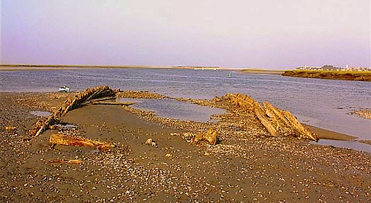
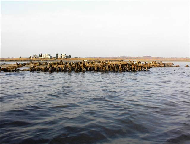
The Emma Shipwreck Site is a historic artifact that can sometimes be viewed on the North River between Marshfield and Scituate at dead low tide.
The Emma was built as a three-masted schooner in Maine in 1882. It was cut down to become a schooner barge, and then abandoned near Damon’s Point on the North River in 1912. On July 4, 1915 it was burned to the waterline. All that remains are the skeletal frames of the hull. Photos of the wreck are used with the permission of Paul F. McCarthy, who retains the copyright.
Note: Water access only. The current in this part of the river is constantly shifting the sand around. Most days, the shipwreck is covered with water, except at dead low tide, where much of it is exposed. This is a historic artifact. Please do not disturb it!
Features
For many years a Damon’s Point shipwreck lay unidentified, disappearing and appearing at least twice as a consequence of violent storms and wave action. The no-name storm of October 30, 1991 (an extreme, Class 5 weather system) uncovered the wreck that we can still observe today. Local Maritime Archaeologist/Historian Paul F. McCarthy engaged in an intensive four-year quest to identify the vessel. His research brought the Emma and her story to light.
This land is within the region of the Massachusett (or Massachuseuk). To learn more about local Native American tribes, we encourage you to interact with their members. The Massachusett tribe at Ponkapoag and the Mattakeeset band of the Massachusett share information on their websites.
Habitats and Wildlife
The Emma Shipwreck site is located within the North River, near Damon’s Point. This is a historic artifact. Please do not disturb it!
The North River rises from marshes and springs in Weymouth, Rockland and Hanson. It is approximately 10 miles in length, with its source at the confluence of the Indian Head River (Hanover) and Herring Brook (Pembroke). From there it flows through the towns of Hanover, Pembroke, Marshfield, Norwell, and Scituate to the Atlantic Ocean between Third and Fourth Cliffs, draining approximately 59,000 acres along the way.
Historic Site: Yes
Park: No
Beach: No
Boat Launch: No
Lifeguards: No
Hours: Dawn to Dusk
Parking: Limited public parking at Damon's Point.
Cost: Free
Trail Difficulty: No trails.
Dogs: No
Boat Ramp: No
ADA Access: No
Scenic Views: Yes
Waterbody/Watershed: North River