
23 Howland Landing, Duxbury, MA 02332, USA
Owned By: Town of Duxbury
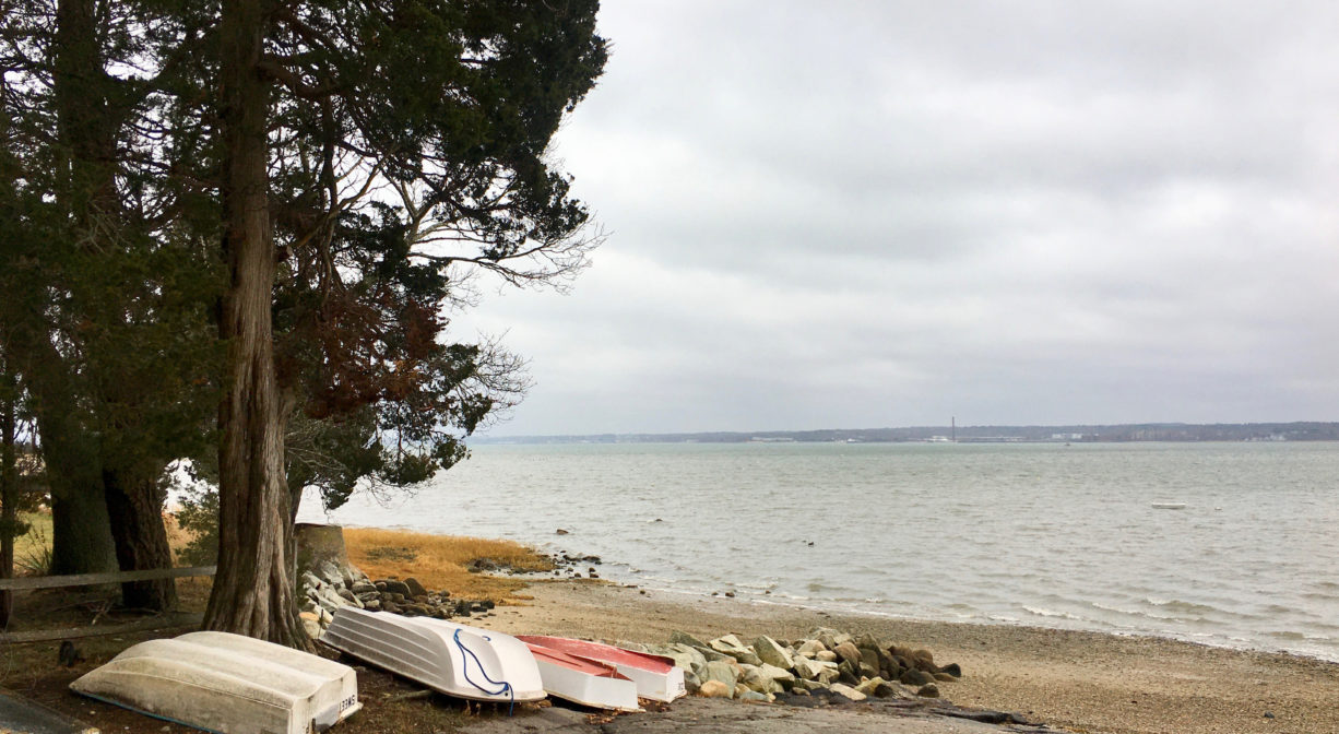
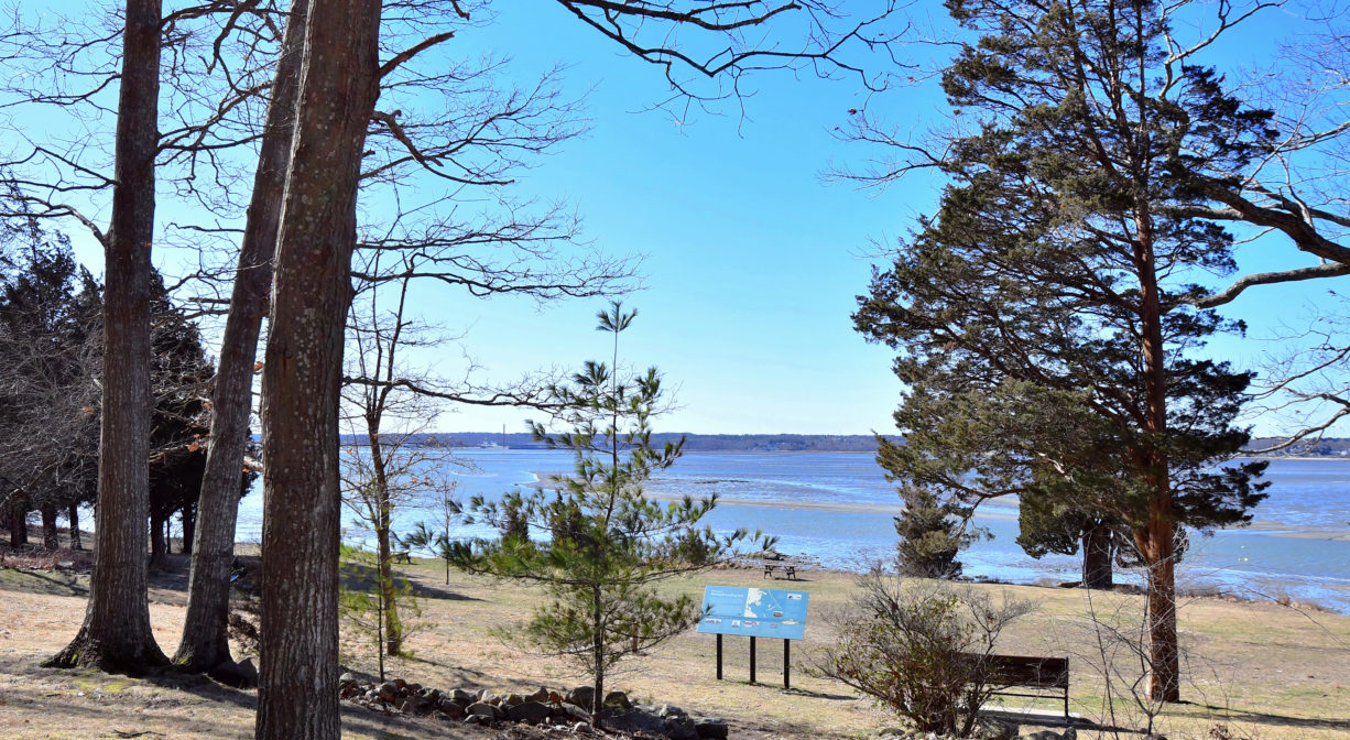
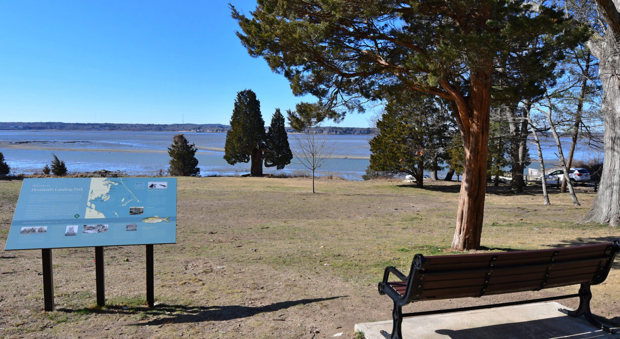
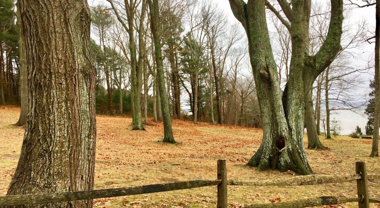
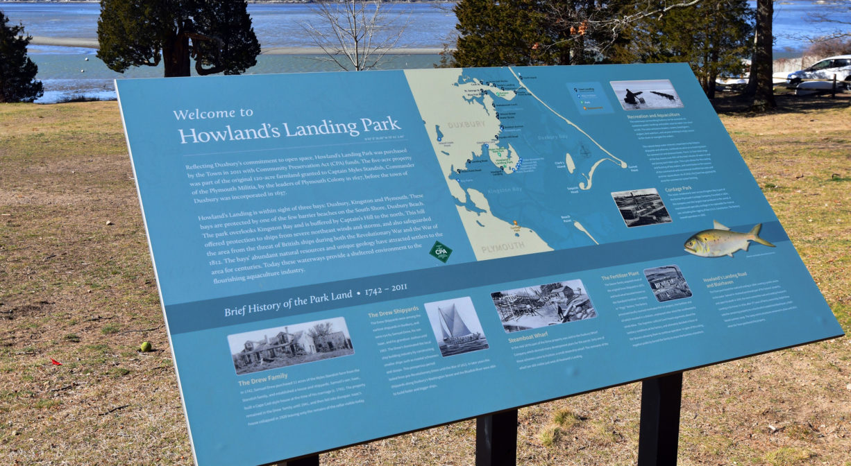
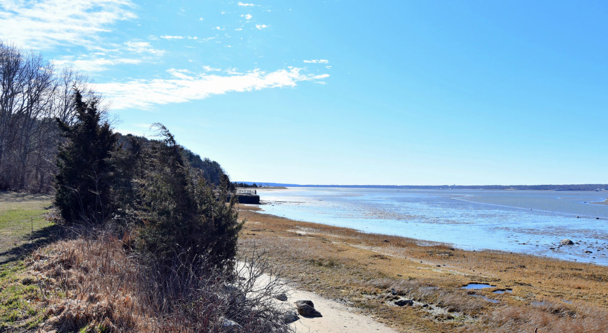
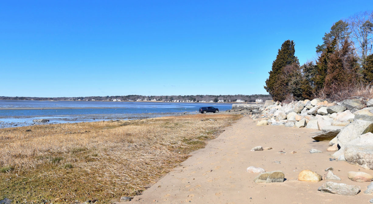
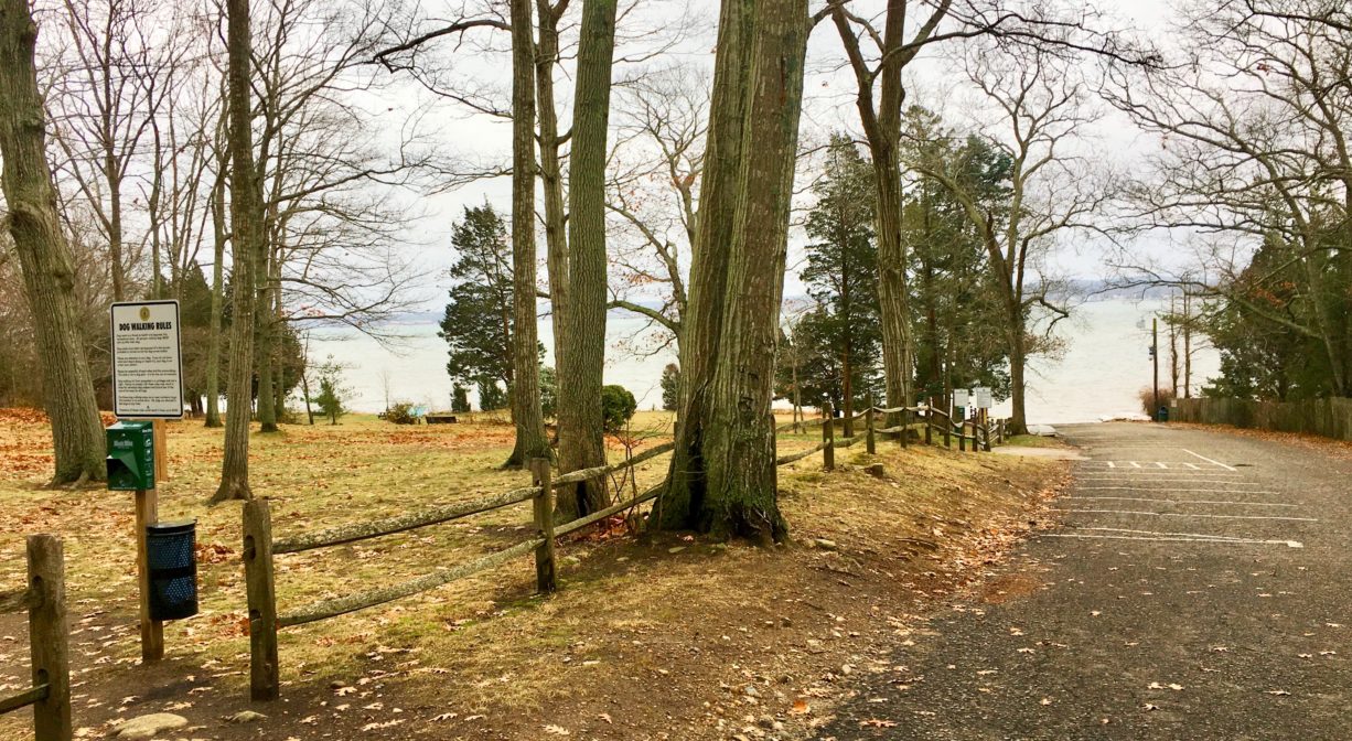
Howland’s Landing Park in Duxbury is located on a hillside overlooking Kingston Bay,in the Standish Shores neighborhood. It features both wooded and grassy areas, plus interpretive signage and a launch area for small boats.
FISHING ADVISORY: It’s important to know that some of our freshwater fisheries are contaminated with mercury, PFAS and/or other concerning substances. The Massachusetts Department of Public Health maintains an online database with up-to-date advisories regarding fish consumption, sorted by location. We recommend you consult this valuable resource when planning a fishing excursion.
Features
This land is within the region of the Patuxet Wampanoag tribe, who for centuries have inhabited the area around the Jones River now known as Duxbury, Kingston and Plymouth. To learn more about local Native American tribes, we encourage you to interact with their members. The Mashpee Wampanoag and the Herring Pond Wampanoag share information on their websites.
The property is part of the original 120 acres granted in 1627 to Captain Myles Standish, Commander of the Plymouth Militia, ten years before Duxbury became incorporated as a town. Sheltered by Captain’s Hill, it looks out onto Kingston Bay. The Myles Standish Monument State Park is located nearby.
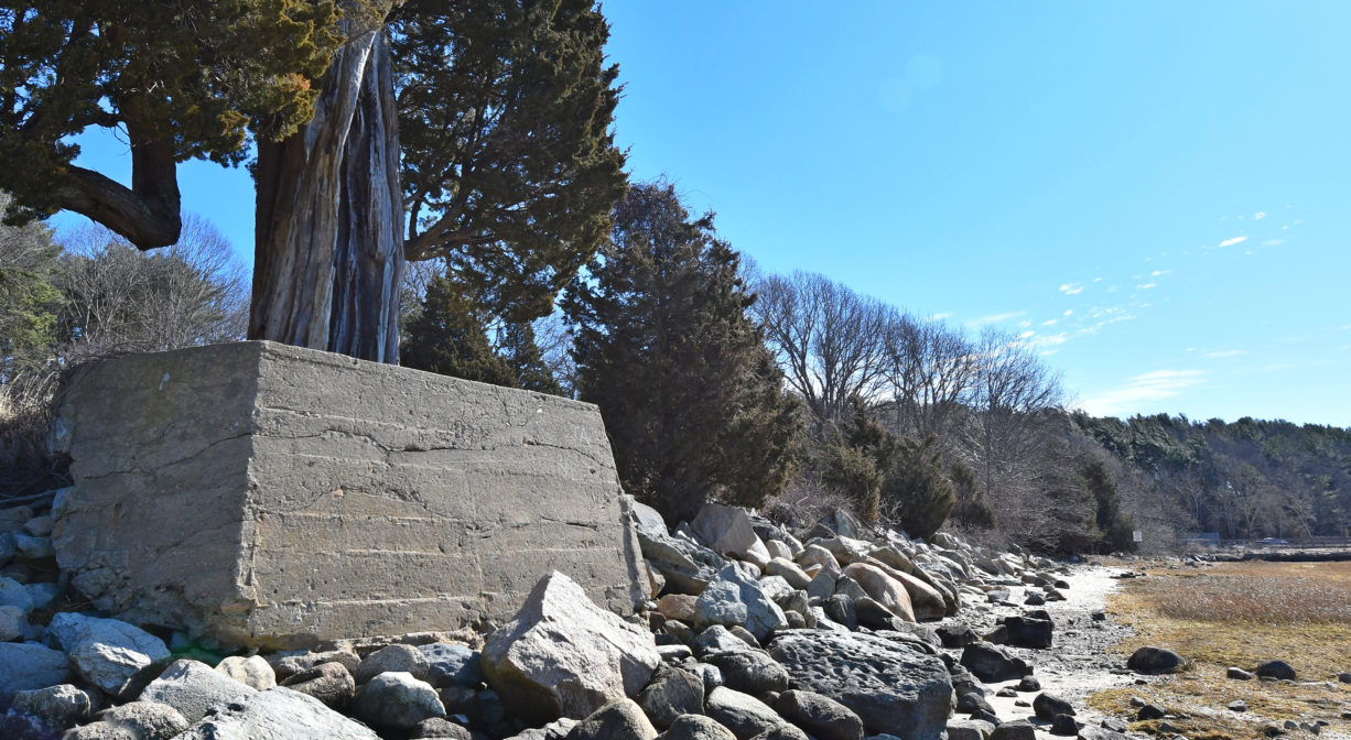
In 1742, members of the Standish family sold 11 acres of their original farm to Samuel Drew, who established shipyards on site, as well as a home. The shipyards were some of Duxbury’s earliest. Three generations of the Drew family (Samuel, Isaac, Joshua) built coastal schooners and sloops until 1863. Isaac Drew, Samuel’s son, built a house on the property around 1781. The house and land remained in the Drew family until 1941, but fell into disrepair. Remains of the cellar are still visible.
In the mid-1870s, the Duxbury Wharf Company purchased part of the property, and developed a small steamship wharf on site. Remnants are still visible, just west of the landing. Then, in 1879, the Seaver Family acquired most of the original Drew shipyard and established the Standard Fertilizer Company. Also known as the “Pogy” factory, the enterprise processed menhaden fish (or pogies) into fertilizer and oil. Neighbors sued the company because of its unpleasant smell. Even though Standard Fertilizer successfully defended its right to operate in this location, it eventually moved elsewhere. Samuel Howland was the next owner of the property, until his death in 1933.
In 1894, the Town of Duxbury purchased the road and landing, to provide public access to the water. After Samual Howland passed away, the town renamed the road and landing in his honor. Ralph Drew sold his family’s remaining acreage to a church in 1934, creating Blairhaven, a summer camp. The Town of Duxbury purchased the camp in 2011 with Community Preservation Act funds, and created Howland’s Landing Park.
Trail Description
No distinct trails, but the hillside is grassy and forested, inviting a pleasant stroll. It is bordered on one side by a split rail fence. For a longer walk, continue up Crescent Street and visit the Myles Standish Monument State Reservation at the top of Captain’s Hill.
Habitats and Wildlife
This grassy property features an open woodland with primarily pine, cedar and oak. There is a small gravel beach on Kingston Bay. Water flows into Kingston Bay.


Historic Site: No
Park: Yes
Beach: Yes
Boat Launch: Yes
Lifeguards: No
Size: 5 acres
Hours: Dawn to Dusk
Parking: Limited on-site parking for 15 cars and 3 trailers.
Cost: Free
Trail Difficulty: Easy, Medium
Facilities:
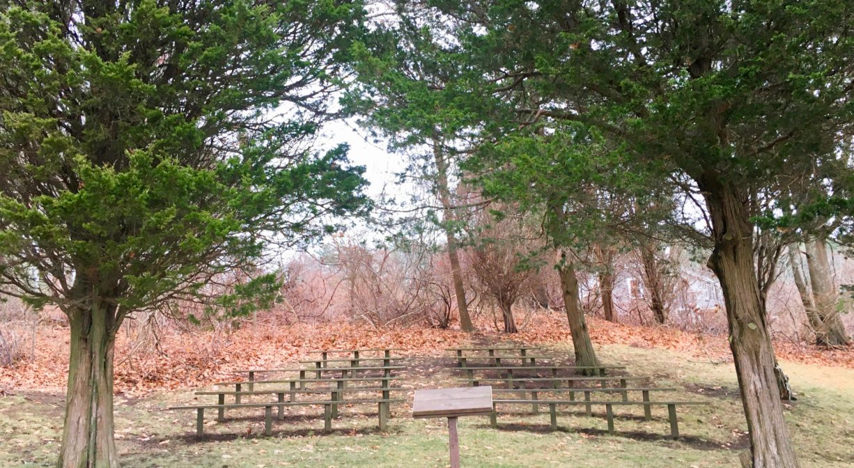
Benches, picnic tables, interpretive signage, pet waste receptacle. There is also a small amphitheater, located within a cedar grove.
Dogs: Dogs must remain on leash. Scoop the poop!
Boat Ramp: Yes
ADA Access: No
Scenic Views: Yes
Waterbody/Watershed: Kingston Bay / Cape Cod Bay