
108-150 Maryland St, Marshfield, MA 02050, USA
Marshfield Conservation: 781-834-5573
Owned By: Town of Marshfield
Marshfield’s Jose Carreiro Woodland features 11 acres of conservation land with more than a mile of trails, plus views of the North River. Trail connections to the adjacent Two Mile Farm.
Hunting is not allowed at Jose Carreiro Woodland, or at any of Marshfield’s other conservation properties.
Features
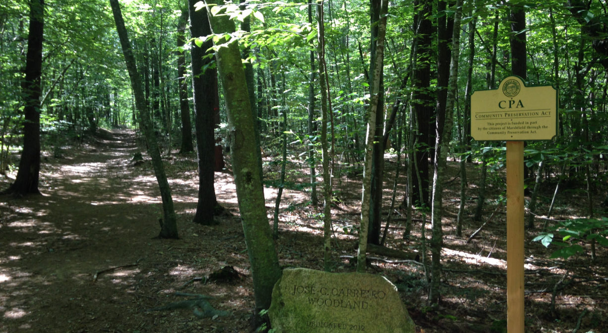
This property is named for Jose Carreiro, who served as Chair of Marshfield’s Community Preservation Committee and was actively involved in protecting this small but beautiful parcel from development. A bench at a spot overlooking the river valley stands in his honor.
The town’s acquisition of the Jose Carreiro Woodland in 2009 marked the successful end to a protracted battle. In the early 2000s, after its longtime owner passed away, the property was slated for development as the 18-unit “North River Village.” Many locals viewed this as a travesty. Walking trails with gorgeous views had existed for years, as well as cart paths that dated back centuries. Plus the area was, and is, environmentally-sensitive, with an endangered species, a large vernal pool, and some archaeological ruins. Plans for development prevailed until the 2007 recession. After a significant drop in market value, the Community Preservation Committee was able to purchase the 11-acre property for $850,000. Eleven acres isn’t much, but when combined with the larger, and equally beautiful Two Mile Farm, it’s a treasure.
The woods in this part of town seem so quiet now. But it isn’t much of a stretch to imagine how different the landscape was 150 years ago. Back then, the once-bustling North River shipbuilding industry was already drawing to a close. The lands that bordered the river had been cleared completely, to make room for agriculture. The trees had all been chopped down and hauled away to local sawmills. But now the trees have grown back, and if we’re fortunate – and if we continue to empower our towns to make good decisions — this time they will remain.
This land is within the region of the Massachusett (or Massachuseuk). To learn more about local Native American tribes, we encourage you to interact with their members. The Massachusett tribe at Ponkapoag and the Mattakeeset band of the Massachusett share information on their websites.
Trail Description
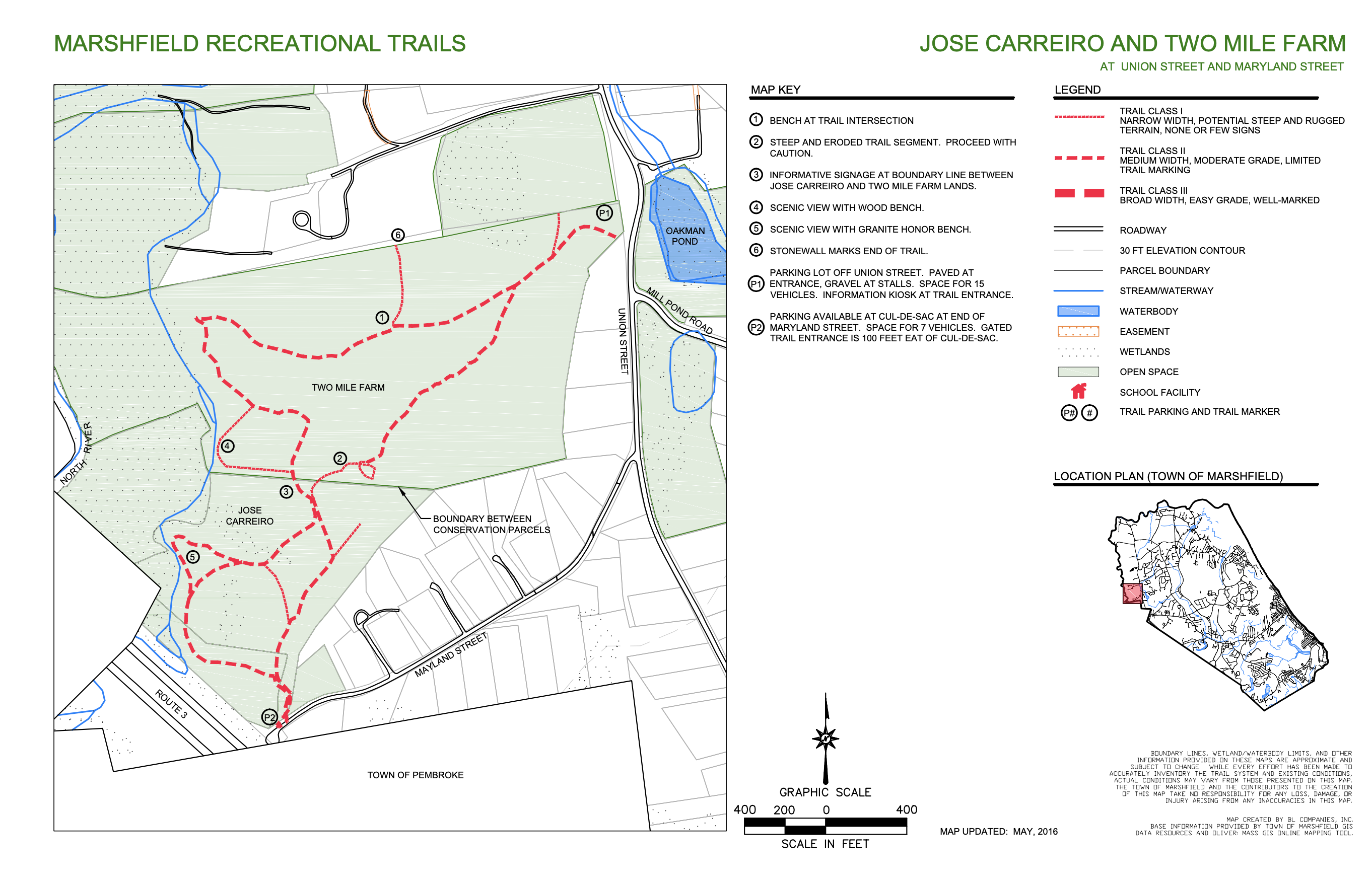
If you’re in the mood for a walk in the woods, the combined 79-acre Jose Carreiro Woodland and Two Mile Farm are worthy of your consideration. You can begin your walk on either property, however if you set off from Carreiro, you’ll finish your walk on a downhill!
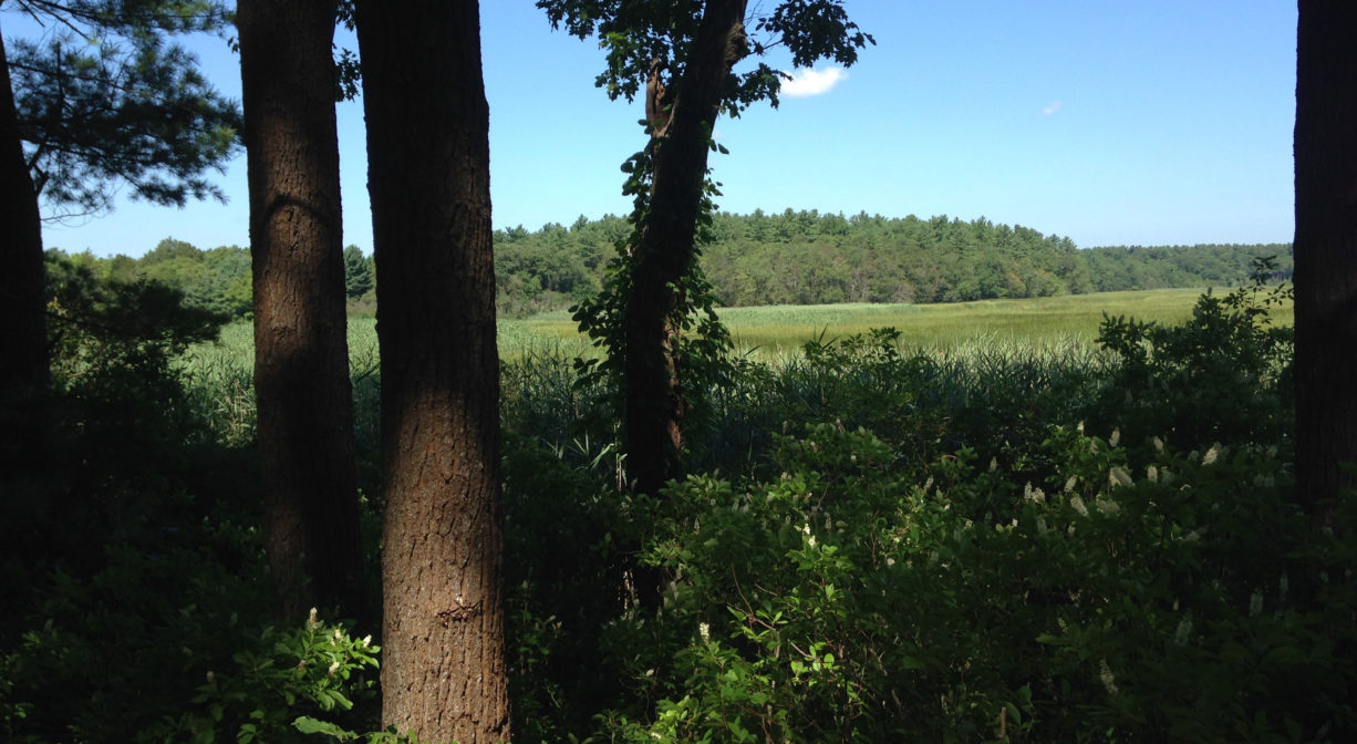
Park at the end of Maryland Street in Marshfield. Facing away from the highway, you’ll see the trailhead on your left. Once you enter the property, you’ll find that there are a number of trail options. An easy-to-remember route is to just keep taking lefts. This will lead you first along Route 3, but soon enough you’ll arrive at a hill that looks out onto the North River and its marshes.
Continuing with the “just take lefts” will lead you through the forest, along the marsh, to the southern entrance to Two Mile Farm. The Trustees (formerly Trustees of Reservations) acquired this 68-acre property in 1995. Continue taking lefts and you’ll be treated to additional views of the river and marsh. Eventually, you’ll begin to head uphill into the woods. Pay careful attention to property boundaries here (they are well marked).
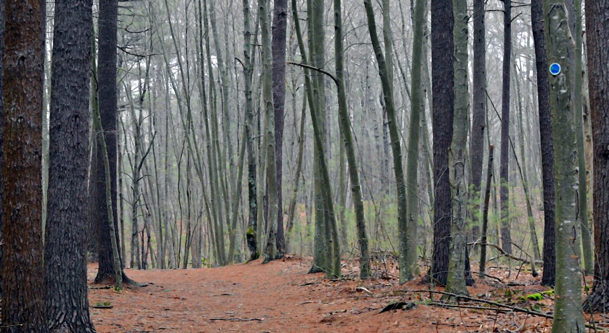
You can continue uphill on a well-developed trail all the way to the property’s northern entrance on Union Street. Or if you’d prefer a shorter, less steep hike, take a shortcut (on the right) down the cart path and back into Carreiro. If you choose the first option, you’ll see a number of old stone walls along your way.
When you get finally to the top of the hill (it’s a long, slow climb) take some time at the kiosk to read about the property’s history. The return trip to Carreiro is mostly downhill from there, through some beautiful pine, oak and beech forest.
Habitats and Wildlife
Pine, oak and beech forest give way to salt marsh and the North River. Oldham Brook runs along the edge of this property before it empties into the North River. Look for it on both sides of the parking area’s cul de sac.
Approximately 10 miles in length, the North River begins at the confluence of the Indian Head River (Hanover) and Herring Brook (Pembroke). From there it flows through the towns of Hanover, Pembroke, Marshfield, Norwell, and Scituate. It empties into the Atlantic Ocean between Third and Fourth Cliffs, draining approximately 59,000 acres along the way.


Historic Site: No
Park: No
Beach: No
Boat Launch: No
Lifeguards: No
Size: 11 acres
Hours: Dawn to Dusk
Parking: Park in the cul de sac at end of Maryland Street in Marshfield.
Cost: Free
Trail Difficulty: Easy
Facilities:
Informational kiosk, benches along the trails.
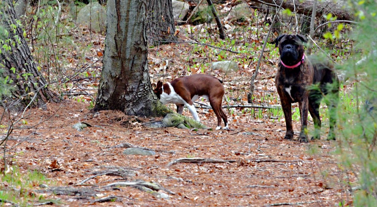
Dogs: Dogs must remain on leash. Please clean up after your pet!
Boat Ramp: No
ADA Access: No
Scenic Views: Yes
Waterbody/Watershed: North River