1176 Ferry St, Marshfield, MA 02050, USA
https://www.marshfieldpolice.org/harbormaster/pages/public-launch-ramps
Owned By: Town of Marshfield
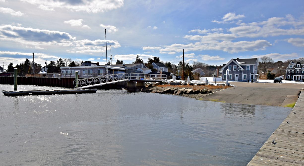
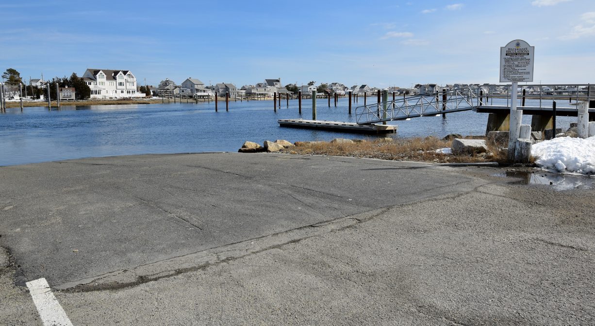
The Marshfield Town Landing is a boat ramp that provides access to the South River for both paddlers and motor boats. Owned by the Town of Marshfield, it is located next to the Marshfield Yacht Club. Across the South River is Humarock, part of the town of Scituate.
Tide Math: High tide at the Marshfield Town Landing is about 30 minutes after the Boston high tide. Set off from here to go clamming!
The shellfish beds in both the North and South Rivers are officially open for the 2024-2025 season, which extends from November 11th to May 31st. Occasionally, temporary closures occur, due to pollution. (We will update this listing if that happens.) Please visit our Shellfishing page for maps and permit info.
FISHING ADVISORY: It’s important to know that some of our freshwater fisheries are contaminated with mercury, PFAS and/or other concerning substances. The Massachusetts Department of Public Health maintains an online database with up-to-date advisories regarding fish consumption, sorted by location. We recommend you consult this valuable resource when planning a fishing excursion.
Features
Launch ramp and town float on the South River near Humarock. You can set off from here to go clamming downstream on the South River (clamflats can be accessed two hours before and after low tides). Map link above shows the areas available for recreational shellfishing in the South River.
The South River, like the North River, is a beautiful tidal estuary where wildlife abounds! Paddling or boating on this estuary allows you to go shellfishing, fishing or just exploring. Downstream there are salt marshes and numerous creeks, host to egrets and blue heron. You might even see a bald eagle! Soft shell clams, better known as “steamers,” hardshell clams, as well as razor clams can be found in the tidal flats, and can be harvested with a permit, in season.
This land is within the region of the Massachusett (or Massachuseuk). To learn more about local Native American tribes, we encourage you to interact with their members. The Mattakeeset band of the Massachusett, and the Massachusett tribe at Ponkapoag, both share information on their websites.
Trail Description
Motorboats can put in here to go out to Massachusetts Bay. Upstream the river has less motorboat traffic and is more conducive to paddling.
Suggested paddling excursions from this location (timing is approximate and depends quite a bit on wind, tide, and your own strength and stamina):
• Put your kayak in the water 1-2 hours before ocean high tide. Ride the rising tide upstream past Rexhame Beach to the Bourne Island Lagoon or the the Kent Park area, and then return to your starting place with the receding tide. (2-3 hours)
• Put your kayak in the water 1 hour before ocean high tide. Head upstream and explore the creeks that are accessible on the inland side of the river, in the vicinity of Rexhame Beach, then return to your starting place. (1-2 hours)
• Stage a second vehicle at Francis Keville Footbridge. Return to Marshfield Town Landing and put your kayak in the water 2-4 hours before ocean high tide. Ride the rising tide all the way up to Keville. (1.5-3 hours)
Habitats and Wildlife
This property is located directly on the South River.
The South River originates deep in Duxbury. Its source is in the Round Pond area, and from there it winds unobtrusively through the woods for several miles. Although one can view it from Route 3, and also from both the South River Bog and Camp Wing conservation areas, it remains a narrow and mostly un-navigable stream until it makes its first “public” appearance at Veterans Memorial Park in Marshfield. From there it flows under Route 3A, through South River Park, and behind the playground of South River School, emerging again at Willow Street. But due to fences, dense vegetation, traffic, and relative navigability none of these are ideal places to access the river by boat. At the Keville Bridge the river is wider, and navigable at most tides. Its course continues as it winds through the marshes, running parallel to Route 139, all the way to Rexhame. From there the river turns northward. It flows for 3 miles between Humarock and the mainland to Fourth Cliff, where it joins the North River at its outlet to the sea.


Historic Site: No
Park: No
Beach: No
Boat Launch: Yes
Lifeguards: No
Size: 1 acre
Hours: Dawn to Dusk
Parking: Public parking for cars at 1176 Ferry Street. Trailer parking requires daily or annual launch sticker from Marshfield Harbormaster.
Cost: Free for cars. Trailers require sticker.
Facilities:
Boat launch and ramp. Loaner lifejackets.
Dogs: Dogs must remain on leash. Please clean up after your pet!
Boat Ramp: Yes
ADA Access: No
Scenic Views: Yes
Waterbody/Watershed: South River