Town of Pembroke: 781-709-1400
Owned By: Town of Pembroke
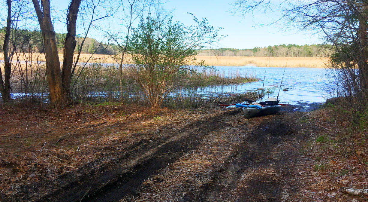
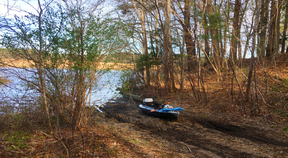
The 33-acre Pembroke Town Forest is located on Brick Kiln Lane. It features a canoe/kayak launch on the North River. Note: the launch area can be muddy/slippery at lower tides. The historic marker for the Brick Kiln Shipyard is a short distance downstream.
Tide Math: High tide at the Pembroke Town Forest is about 2.5-3 hours after the Boston high tide.
FISHING ADVISORY: It’s important to know that some of our freshwater fisheries are contaminated with mercury, PFAS and/or other concerning substances. The Massachusetts Department of Public Health maintains an online database with up-to-date advisories regarding fish consumption, sorted by location. We recommend you consult this valuable resource when planning a fishing excursion.
Features
There are no established walking trails here. However, it’s the perfect spot to launch a canoe, kayak or paddleboard. Be sure to make note of your surroundings before you depart. From the water, the landing area is not easy to spot. A helpful landmark is the Brick Kiln Yard historic marker, a short distance downstream. Whether you paddle upstream or downstream, this is a lovely section of the river to explore. Be aware that at lower tides, this launch area can be quite muddy and slippery.
This land is within the region of the Massachusett (or Massachuseuk) Native American tribe. The Mattakeeset band of the Massachusett lived for thousands of years in the North River watershed. Their village included most of today’s Pembroke and Hanson. To learn more about local Native American tribes, we encourage you to interact with their members. The Massachusett tribe at Ponkapoag and the Mattakeeset band of the Massachusett share information on their websites.
Trail Description
No trails, but here are some suggestions for paddling excursions (Timing is approximate and depends quite a bit on wind, tide, and your own strength and stamina.):
• Put your kayak in the water at ocean high tide or within an hour after. Paddle downstream to Route 3 while the tide is relatively slack, and and then return to Pembroke Town Forest with the incoming tide. (2+ hours total)
• Put your kayak in the water at ocean high tide or within 1-2 hours after. Paddle upstream to the Washington Street Bridge, and and then return to Pembroke Town Forest as the tide begins to recede. (2+ hours total)
• Put your kayak in the water an hour before ocean high tide. Paddle downstream, continuing past Route 3 to Couch Beach. Enjoy some rest at Couch Beach and then return to Pembroke Town Forest as the tide begins to rise. (4+ hours total)
• Put your kayak in the water at ocean high tide or within an hour after. Paddle upstream, continuing past the Washington Street Bridge to the upper reaches of the North River, including Herring Brook at the Indian Head River, and then return to Pembroke Town Forest as the tide begins to recede. (3+ hours total)
• Stage a second vehicle at the Hanover Public Launch. Return to Pembroke Town Forest and put your kayak in the water 1-3 hours after the ocean high tide. Enjoy a one-way excursion to Hanover, with views along the way of Fox Hill Shipyard, Third Herring Brook, the Washington Street Bridge, and Herring Brook. (2+ hours total)
• Stage a second vehicle at the Marshfield Launch at Union Street Bridge. Return to Pembroke Town Forest and put your kayak in the water 2-3 hours after the ocean high tide. Enjoy a one-way excursion to Marshfield, with views along the way of Route 3, Couch Beach, and various historic shipyards. (3+ hours total)
Habitats and Wildlife
The property is located directly on the North River.
Approximately 10 miles in length, the North River begins at the confluence of the Indian Head River (Hanover) and Herring Brook (Pembroke). From there it flows for 10 miles through the towns of Hanover, Pembroke, Marshfield, Norwell, and Scituate. It empties into the Atlantic Ocean between Third and Fourth Cliffs, draining approximately 59,000 acres along the way.


Historic Site: No
Park: No
Beach: No
Boat Launch: Yes
Lifeguards: No
Size: 33 acres
Hours: Dawn to Dusk
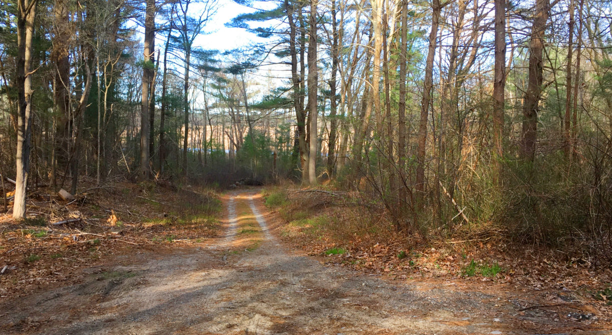
Parking: Limited on-site parking. Follow Brick Kiln Lane past all of the houses. The road continues through the woods. Soon after the houses, look for a dirt road that heads downhill toward the river (it is on the right). At the end of this narrow dirt road is a small unpaved parking area and a launch area for canoes and kayaks.
Cost: Free
Facilities:
Geocache location, boat launch area on North River.
Dogs: Dogs must remain on leash. Please clean up after your pet!
Boat Ramp: No
ADA Access: No
Scenic Views: Yes
Waterbody/Watershed: North River