
9 Washington St, Pembroke, MA 02359, USA
Town of Hanover: 781-826-5000 and Town of Pembroke: 781-293-2300
Owned By: Towns of Hanover and Pembroke
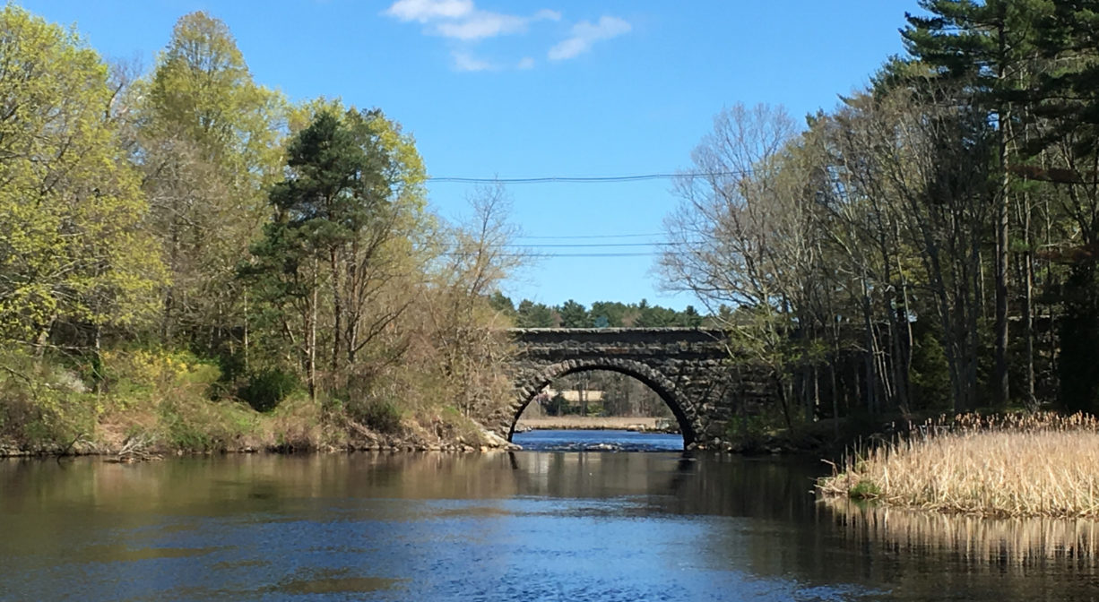
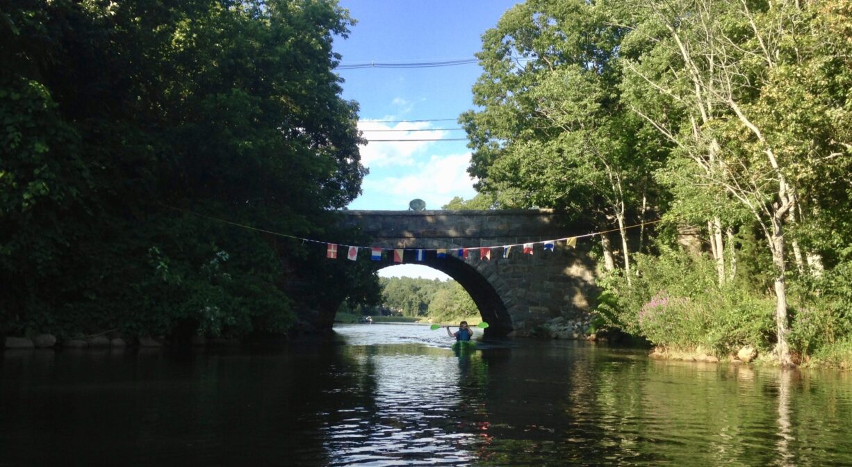
The beautiful and historic Washington Street Bridge spans the North River between Pembroke and Hanover. Launching a canoe or kayak here is not recommended. Instead, visit the Hanover Public Launch (upstream) or the Pembroke Town Forest (downstream).
Note: Plan ahead and use extreme caution when paddling under the Washington Street Bridge. The North River narrows significantly at this spot, in order to flow between the abutments of the stone bridge. When the tide and/or current are in your favor, passing beneath the bridge can be an exhilarating flume ride. But when the tide and/or current are going the opposite direction than you are, it can be extremely difficult — even impossible — to paddle under the bridge.
Tide Math: High tide at the Washington Street Bridge is about 2.5-3 hours after the Boston high tide.
Features
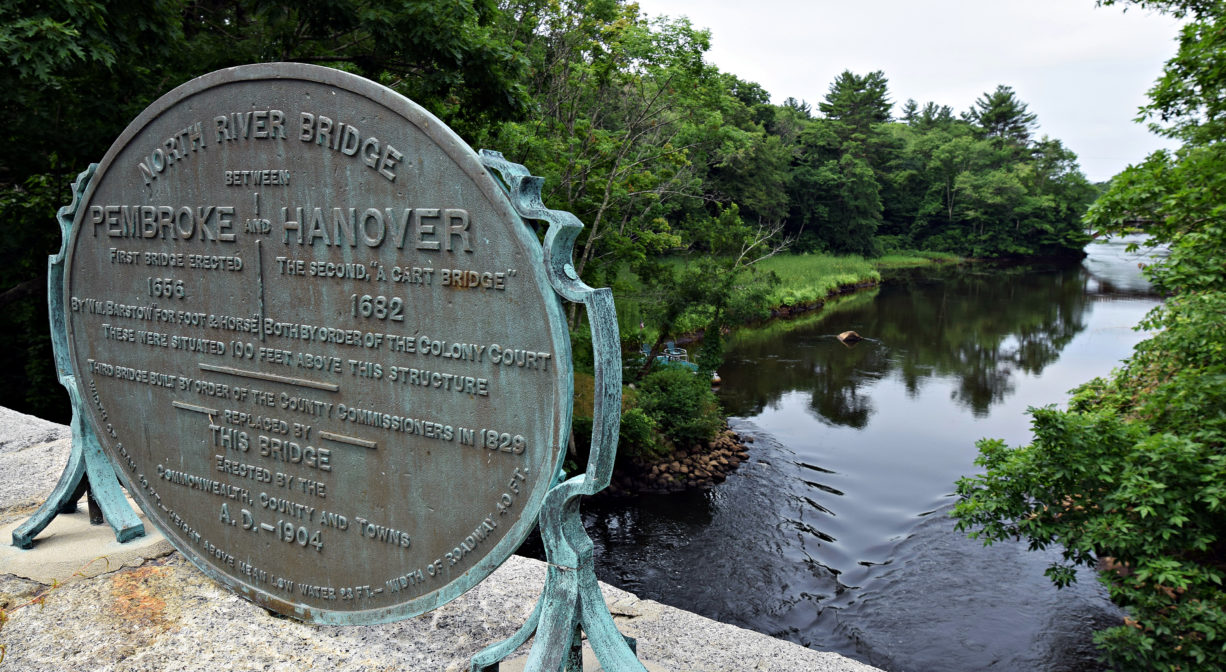
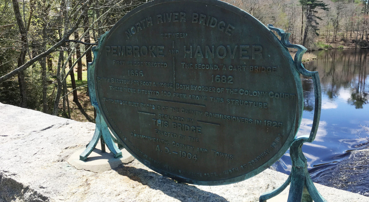
In 1656, Plymouth Colony paid William Barstow 12 pounds sterling to build the first bridge across the North River. For foot and horse traffic only, it stood about 50 feet upstream (southwest) of the existing bridge on Washington Street. Barstow also owned the land that is now the location of Historic Sylvester Field. Barstow’s Bridge was replaced in 1682 with a cart bridge; the old stone abutments still remain. The existing location dates back to 1829. The current bridge was constructed in 1904.
Barstow’s Bridge was located at a place called Stoney Reache. William Barstow, who also kept a tavern nearby, received £20 for maintaining the bridge from 1656 to 1682, however he died in 1668. When the original bridge was replaced by a cart bridge in 1682, construction costs were shared equally by the towns of Scituate, Duxbury and Marshfield. (Hanover and Norwell were both part of Scituate at the time, and Pembroke was part of Duxbury.)
The river marks the town line between Pembroke and Hanover. The road that passed over Barstow’s Bridge eventually became part of the Old Turnpike Road from Boston to Plymouth, with stagecoaches roaring down the hill and across the bridge. In 1829, a stone bridge was built, to replace Barstow’s Bridge. It stood about 50 feet downstream, and became known as North River Bridge. The bridge was razed and rebuilt around 1870, with the hills on either side graded for a less severe drop and climb.
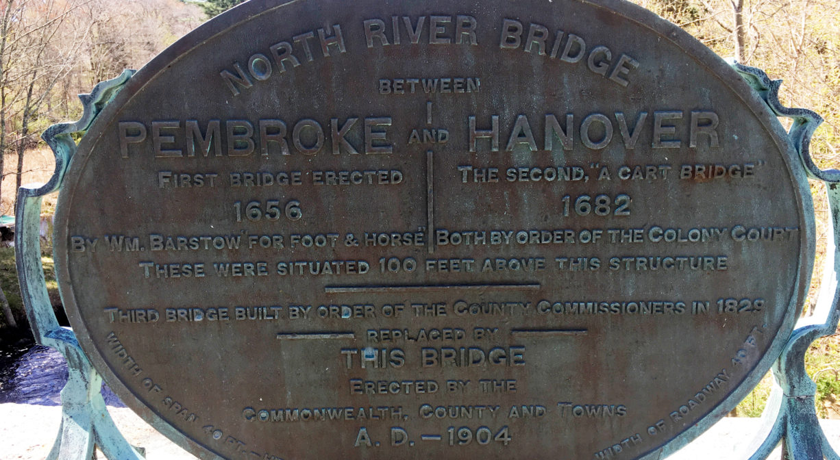
There is a plaque mounted on the bridge that reads as follows: North River Bridge between Pembroke and Hanover. First bridge erected 1656 by William Barstow for foot & horse. The second, “a cart bridge” 1682. Both by order of the Colony Court. These were situated 100 feet above this structure. Third bridge built by order of the County Commissioners in 1829. Replaced by this bridge, erected by the Commonwealth, county and towns, A.D. 1904. Width of span 40 feet – height above mean low water 23 feet – width of roadway 40 feet.
Packet ship lines were established prior to 1670, and thrived until railroads came to the South Shore in the mid-to-late 1800s. Over time, White’s Ferry, Little’s Bridge (today’s Route 3A Bridge), Union Street Bridge, Hobart’s Landing, Foster’s Landing, Job’s Landing, Brick-Kiln Yard, and the North River Bridge (Washington Street Bridge) became regular stops. Farmers would meet the packet ship and barter their home-grown goods for goods from China and Mediterranean, such as coffee, sugar and spices. Packet pilots also bought wood, fish, pot iron, and charcoal from locals, and sold them lumber and ship supplies. A typical packet run, up and down the river, could take three or four days.
This land is within the region of the Massachusett (or Massachuseuk). To learn more about local Native American tribes, we encourage you to interact with their members. The Massachusett tribe at Ponkapoag and the Mattakeeset band of the Massachusett share information on their websites.
Habitats and Wildlife
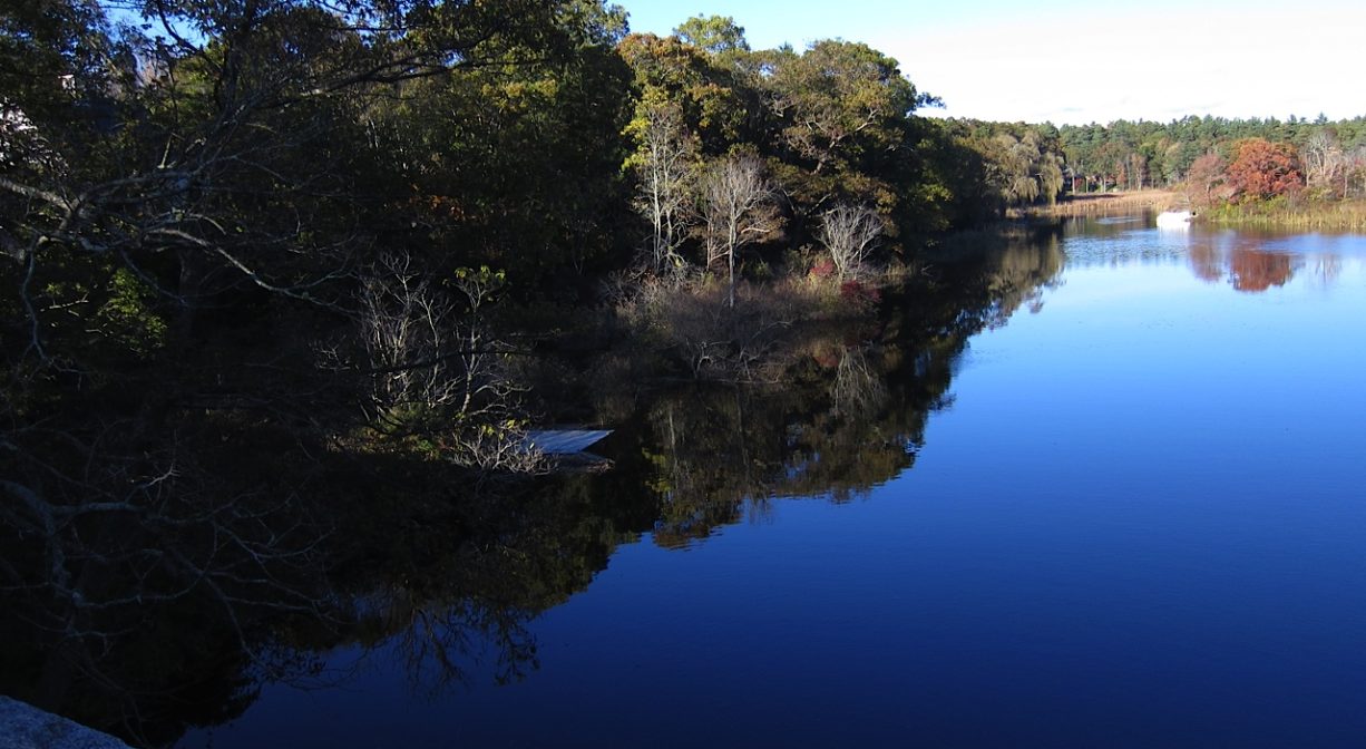
The Washington Street Bridge spans the North River. Approximately 10 miles in length, the North River begins at the confluence of the Indian Head River (Hanover) and Herring Brook (Pembroke). From there it flows through the towns of Hanover, Pembroke, Marshfield, Norwell, and Scituate. It empties into the Atlantic Ocean between Third and Fourth Cliffs, draining approximately 59,000 acres along the way.


Historic Site: Yes
Park: No
Beach: No
Boat Launch: No
Lifeguards: No
Hours: Bridge is always open.
Parking: No public parking.
Cost: Free
Facilities:
Historic markers.
Dogs: Dogs must remain on leash. Please clean up after your pet!
Boat Ramp: No
ADA Access: No
Scenic Views: Yes
Waterbody/Watershed: North River